
Would Elizabeth I recognise Islington today?
- London On The Ground
- Aug 28, 2022
- 7 min read
An old greetings card shows 'The Village of Islington or Iseldon In the Reign of Queen Elizabeth I'.

I recently came across an old greetings card with this illustration. It cleverly adopts the style of Civitas Londinum, a woodcut whose blocks were made most likely in the 1560s (during the reign of Queen Elizabeth I). The style is a combination of a map and a bird's eye view, with major buildings and some landscape features shown in relief.
There is nothing on the card to indicate its date of production, but it was acquired in 1987 from the now defunct Canonbury Bookshop. I assume that the drawing was created in the 1970s or 1980s.
Walks available for booking
For a schedule of forthcoming London On The Ground guided walks, including a brand-new Upper Street walk, please click here.
In the middle of the 16th century, shortly before Elizabeth came to the throne, Islington was a rural village outside London, with around 450 inhabitants. It consisted of Upper Street and Lower Street (now Essex Road) and not much else apart from fields and a few grand houses. However, it did have 15 inns/taverns, which works out at one for every 15 inhabitants!
Upper Street was part of the major north/south route for drovers bringing livestock into Smithfield Market. The inns were used by drovers as a stopover, while Islington's fields were used as pastures for their animals and local dairy cattle.
That 16th century village, and some of the mansions it contained, are well captured in the illustration. The picture includes a key, which notes eight buildings and locations.
How many of these can we still see today? Let's go through them, starting in each case with what is written in the key to the illustration.
1. Canonbury House and Tower, owned by Sir John Spencer, Lord Mayor of London 1594-95. The Tower and the octagonal houses at the corners of the gardens are still standing.

Canonbury House was the country retreat of the Canons and Prior of St Bartholomew's Priory in Smithfield. The de Berners family, the biggest landowners in Islington since the time of the Domesday Book in 1080, gave the Canons the triangle of land that consequently became known as Canonbury in the 13th century. It is bounded by Upper Street to the west, Lower Street (now Essex Road) to the east and Hopper Lane (now St Paul's Road) to the north.
In the early 16th century the penultimate Prior of St Bartholomew's, William Bolton, built an impressive courtyard mansion here. After Henry VIII closed all the Monasteries, Canonbury House passed through the hands of many prominent people, including Thomas Cromwell (chief minister to Henry), Anne of Cleves (Henry's fourth wife), John Dudley (Duke of Northumberland, father in law of 'Nine Day Queen' Lady Jane Grey) and Sir John Spencer.
It was Spencer who added the Tower in the late 16th century, the only part of the Tudor Canonbury House that survives today. It has had some restoration work, notably in the early 20th century, but can claim to be the oldest building in Islington.

The octagonal brick pavilions placed by Bolton at the southern corners of the gardens also still stand, but are now incorporated into 19th century private houses.
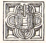
The one that marked the garden's southwest corner (on today's Alwyne Villas) still displays Prior Bolton's symbol in stone just below a window. This symbol, or rebus (an image of a bolt, or crossbow arrow, passing through a barrel, known as a tun, forming a visual pun on his surname: bolt tun). The same rebus can also be seen in the church of St Bartholomew the Great at Smithfield.


2. The Parish Church.

The Islington parish church of St Mary's at the time of Queen Elizabeth I had been built in the 1480s, although there had likely been a Saxon and a Norman church before that.
The Tudor church depicted in the illustration was pulled down in 1751 as it was too small for Islington's growing population. It was also rather dilapidated, although its stone tower was strong enough to resist attempts to bring it down with gunpowder. It only tumbled when a fire was set in its foundations and wooden scaffolding erected around it.
A new church, neoclassical in style, was completed in 1754 by a joiner/architect named Launcelot Dowbiggin. His influences for the spire included Christopher Wren's St Mary le Bow and St Bride's, both in the City, and George Dance the Elder's St Leonard's Shoreditch.
Dowbiggin's church suffered a direct hit from a German bomb on 9 September 1944, the third night of the Blitz. Only his tower and spire remain, while the body of the church that we see today dates from 1956. It was designed by architects John Seely and Paul Paget, who became specialists in post-war church reconstruction.

3. The supposed Residence of Sir Walter Raleigh. Afterwards converted to the Pied Bull Tavern.

Sir Walter Raleigh, the soldier, explorer and poet, was a great favourite of Queen Elizabeth I, but executed under her successor James I. He may or may not have had a large house on Upper Street, roughly where the junction with Theberton Street is today.
There certainly was a large old house on that location, which had become the Pied Bull tavern by 1725. The pub that stands on the site today is called the Bull, an echo of this previous incarnation.

4. Islington Green, with the stocks and the maypole.

Islington Green remains a green open space, the point where Upper Street and Essex Road divide, but there are no longer any stocks or a maypole.

5. The Mansion of Sir Thomas Fowler, built in this reign.

The Fowlers were lords of the Manor of Barnsbury, which is the area to the west of Upper Street and once extended much further north into Holloway. The name Barnsbury is a corruption of Bernersbury, another reference to the land-owning de Berners family of Norman times.
Sir Thomas Fowler was a courtier to both Henry VIII and Elizabeth I. It is said that Elizabeth would ride out to Islington to visit him and other local bigwigs. He did not live in Barnsbury, but had a large estate at the eastern end of Cross Street (so-called because it was the route where one could cross from the Upper Street to the Lower Street).
His mansion stood roughly where the Cross Street Baptist Church is today, on the north side of the street. Just behind this church, off Halton Road, there is a street called Fowler Road and a residential block called Fowler House.

6. The House built by Sir Thomas Lovell in the reign of Henry VIII. Later a residence of the Earl of Leicester.

Sir Thomas Lovell was variously Speaker of the House of Commons, Secretary to the Treasury and Chancellor of the Exchequer (a position he held for 39 years from 1485 until his death in 1524), serving under the first two Tudor monarchs, Henry VII and Henry VIII.
His Islington house stood on the southern side of Greenman Street, which may also have been the location of an earlier mansion, that of Queen Elizabeth's cousin Henry Carey, Baron Hunsden (Anne Boleyn was his aunt).
Carey had a two year affair with Emilia Lanier (née Bassano), the first woman to declare herself a poet and thought by some to be the inspiration for the 'Dark Lady' of William Shakespare's sonnets.
Subsequently, as Lord Chamberlain, he was the patron of William Shakespeare's theatre troupe (who then became known as the Chamberlain's Men).
After Sir Thomas Lovell, the property became the residence of Sir Robert Ducy (or Duce), who was a banker to Charles I and a Lord Mayor of London in the 17th century.
The mansion was known for its decorated windows and splendid chimney-piece with the arms of the City of London. It was pulled down in 1800.
Today, the Green Man pub and the Peabody housing estate, both buildings from the 1860s, stand approximately where these grand mansions once were.

7. The Queen's Head Tavern. One of the first licensed houses. Licensed by the Queen to Sir Walter Raleigh for the sale of wine.

There has been a pub or tavern on this location in Essex Road for many centuries, although - as with the house on Upper Street - the connection with Raleigh is not proven. Queen's Head Street (formerly Queen's Head Lane) takes its name from the tavern and is one of the earliest roads leading off Essex Road to the west/southwest.
The pub that stands here today, called The Old Queen's Head, is of c.1830 construction, although its front on Essex Road dates from around 1900.

However, the ground floor bar incorporates early 17th century details from the previous building, which was demolished in 1829. These are the wonderful moulded plasterwork on the ceiling and a carved stone and wooden chimney piece.

8. The Lazar House (leper hospital) and Chapel, founded in the 15th century. Lepers could follow the services unseen.

There were six Lazar Houses, where lepers could be isolated from the rest of the population in the countryside outside the City of London. The hospital depicted in the illustration most likely refers to the leper hospital that stood on the west side of Kingsland Road.
This is a little further east than suggested by the drawing, in today's borough of Hackney. Sources differ on when the Kingsland leper hospital was founded, varying from the 13th to the 15th century. It was called Le Loque and also treated those suffering from syphilis.
The administration of the six Lazar Houses was transferred to St Bartholomew's Hospital in the late 1540s. The Kingsland hospital closed in 1760 and the building was leased out.
The site is currently occupied by a chicken restaurant, in what looks like a 19th century building that was probably once a pub, on the corner of Kingsland Road and Bentley Road.

Its connection with St Bartholomew's is betrayed by the small stone shield on the brick wall on Bentley Road. This depicts the hospital's heraldic symbol.

The notes to the illustration end with a helpful reminder about changed road names:
Lower Street is now Essex Road. Hopper Lane is now St Paul's Road. Back Lane is now Liverpool Road.
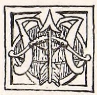
The top left corner of the picture shows the Bolton rebus (described above), while the symbol at top right is the crest on Islington's coat of arms. The latter combines the de Berners family symbol of a water bouget (a pair of water bags on a yoke), together with an arrow symbolising Islington's historic connections with archery.
Tiny script on the card reads: "Published by the Canonbury Bookshop and to be sold only at their premises, 268 Upper Street". It also includes little scrolls crediting R. Oakley with the text and F. Wagstaff with the drawing. The bookshop is now long gone and I have not been able to discover anything about the card's creators.
Alas, hardly anything of Tudor Islington still exists today. However, thanks to the Canonbury Bookshop, R. Oakley and F. Wagstaff (and to Annemarie Fearnely for bringing the card to my attention), we have a charming illustration of how Islington might have looked to Queen Elizabeth I.
Walks available for booking
For a schedule of forthcoming London On The Ground guided walks, including a brand-new Upper Street walk, please click here.


Comments